Ali Curung
Ali Curung is 170 km south of Tennant Creek in the southern Barkly region. The community is accessible by road and has a local store, bakery, police station, petrol station, community hall and an arts and culture centre.
Amoonguna
Amoonguna is 21km southeast of Alice Springs, near the Todd river and is accessible by road. The community has a local store, women's centre and community hall.
Ampilatwatja
Ampilatwatja, located 320km northeast of Alice Springs, is found in central Northern Territory on the Aherrenge Aboriginal Land Trust. The community has a women's centre, basketball courts and a community store with a petrol station.
Anmatjere
Anmatjere is 194km north of Alice Springs in the central desert of the Northern Territory. The community has a local store, a community hall, a police station and a caravan park that supplies petrol.
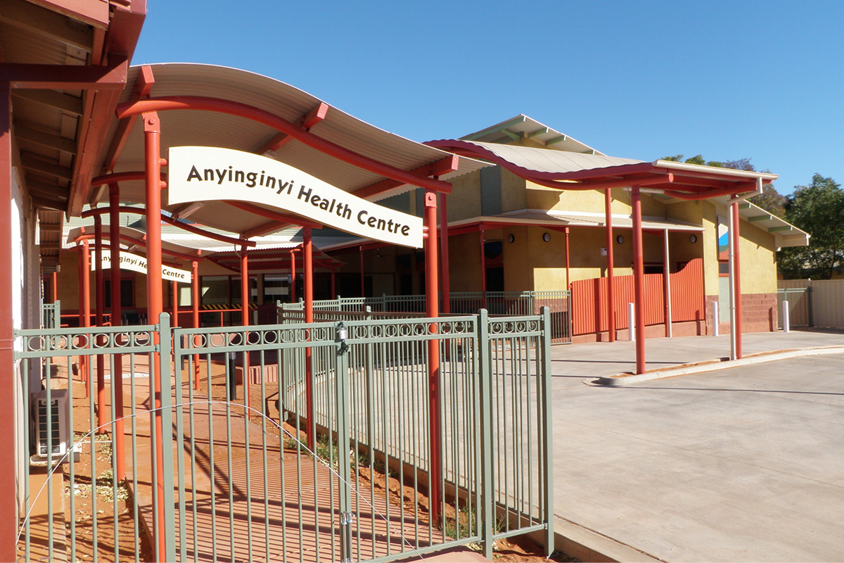
Anyinginyi
Anyinginyi is 500 kilometres north of Alice Springs and 1000 kilometres south of Darwin. Located in the heart of the Barkly Region, this community has a police station, a local store and multiple restaurants and cafes.
Aputula
Aputula is about 317 km south of Alice Springs and is accessible by road and air. The community has a local store, a petrol station, a community hall and a recreational hall.
Areyonga
Areyonga is nestled in a valley at the western end of the MacDonnell Ranges, about 240km west of Alice Springs. The community has a local store, swimming pool, football oval, basketball court and community hall.

Atitjere (Harts Range)
Atitjere is located 215km northeast of Alice Springs. It has a community store, accommodation, fuel and a police station. You can enjoy seasonal sports, 4WD driving tracks and camping.
Canteen Creek
Canteen Creek, located southeast of 275km of Tennant Creek, is adjacent to the creek of the same name on the northern edge of the Davenport Ranges. The community has a local store, a community hall and a sports recreation centre.
Elliott
Elliott is located 250kms north of Tennant Creek. The community is accessible by road and air. It has a local store, fuel station, police station and sport and recreation facilities.
Engawala
Engawala is located 180km northeast of Alice Springs. The community is accessible by road and air and has a local store, accommodation, fuel, playground and sporting field.
Haasts Bluff
Haasts Bluff is 250km west of Alice Springs amongst the West MacDonnell Ranges. The community has a local store, petrol station, a basketball court, an AFL football field and an arts centre.
Hermannsburg
Hermannsburg, located 130km west of Alice Springs, is accessible by road all year round. The community has a supermarket, local store, police station, arts centre and a historic precinct.
Imanpa
Imanpa is 270km from Alice Springs and can be accessed by road. The community has a local store, art centre, children's playground and sports centre.
Kaltukatjara (Docker River)
Kaltukatjara is located 230kms west of Yulara and 673km southwest of Alice Springs. The community is accessible by road and air. There is 180kms of dirt road that is prone to flooding. It has a local store, police station and sports facilities.

Kintore
Kintore is 530km from Alice Springs and 3km from the WA border. The community is accessible by road and has an art centre, football oval, swimming pool, police station and a local store with a petrol station.
Ltyentye Apurte
Ltyentye Apurte is about 80km east of Alice Springs and is accessible by road. The community has a police station, petrol station, a recreational hall, a basketball stadium, ALF football oval and a local store that supplies petrol.
Mount Liebig
Mount Liebig is 310km west of Alice Springs at the western end of the Western McDonnell Ranges. The community has a local store, arts centre, football oval, basketball court and a petrol station.
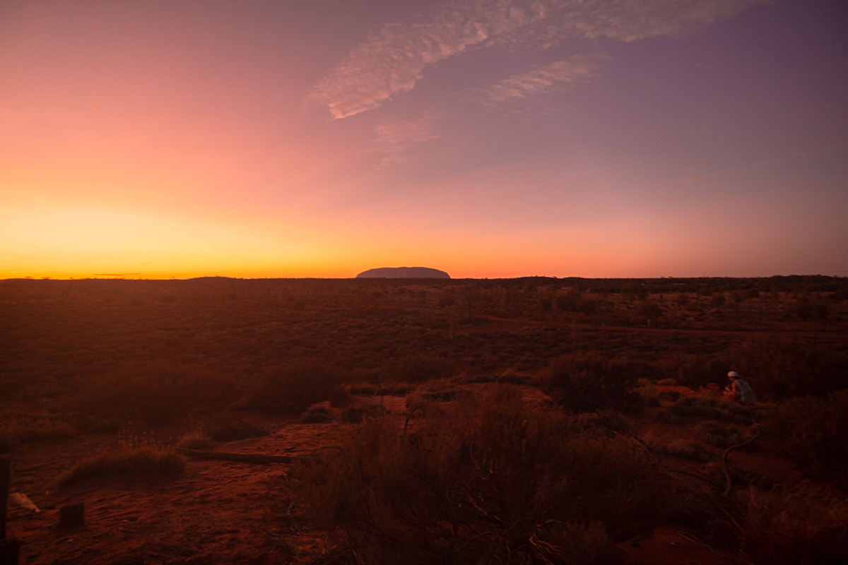
Mutitjulu
Mutitjulu is within the Uluru-Katatjuta National Park, at the base of Uluru, 470km southwest of Alice Springs. The community has a swimming pool, basketball court, AFL and football field, a cafe and a local store that supplies petrol.
Napperby (Laramba)
Napperby is 122km north of Alice Springs. The community is accessible by road and air and has a community store, arts centre and recreational sports activities.
Nyirripi
Nyirripi is 440kms from Alice Springs. The community is accessible by road and air and has a local store, police station, fuel and a music hall.
Papunya
Papunya is 250km west of Alice Springs along the MacDonnell Ranges. The community is accessible by road and has a local store, a sporting ground, football oval, disco hall and arts centre.
Titjikala
Titjikala is 130kms southeast of Alice Springs. The community is accessible by unsealed road and has a local store. Titjikala enjoys seasonal sports and has a children's playground.
Ulana
Ulana is 120km west of Alice Springs. The community is accessible by road and had cultural tours, an art gallery, local store and annual picnic horse races.
Utopia
Utopia is 248 km northeast of Alice Springs by road. During the wet season, the community is only accessible by air. The community has a local store, petrol station and police station.

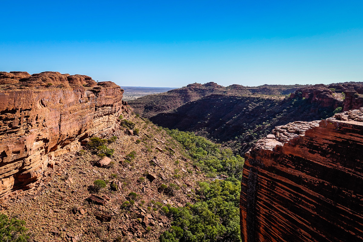
Watarrka (Kings Canyon)
Watarrka is 300km southwest of Alice Springs and 180km north of Yulara. The community is accessible by road and air, and has a local store, bush walking, restaurant and swimming pool.
Wirliyatjarrayi
Wirliyatjarrayi is 337km northwest of Alice Springs, located in the central Northern Territory. The community has a local store, police station and petrol station.
Yuelamu
Yuelamu is 280km northwest of Alice Springs. The community is accessible by road and air, and has a local store, fuel, and sporting and cultural facilities.
Yuendumu
Yuendumu lies on the edge of the Tanami Desert, 290km northwest of Alice Springs in the central desert region. The community has two local stores, a police station, a petrol station, a community hall and a swimming pool.

DISCLAIMER:
NT Remote Locum Program is in the process of updating detailed community profiles to reflect the amendments below:
- Some detailed community profiles currently state that NT Remote Locum Program HPs are not required to obtain permits for their placement as they are exempt under legislation related to Emergency Response. This is incorrect. Please note that it is a legal requirement under Commonwealth and Northern Territory law that a written permit is required to enter or remain on Aboriginal land for all our HPs.
- Some detailed community profiles currently do not reflect that the clinics are now Aboriginal Community Controlled Health Services (ACCHS).
- Some detailed community profiles currently do not reflect that Miwatj Health are the health service in the following locations: Nhulunbuy, Yirrkala, Gunyangara, Galiwin'ku, Milingimbi, Gapuwiyak and Ramingining.
We are working hard to ensure that the detailed community profiles are updated as soon as possible to include the above information.
If you would like further information or clarification about these amendments, or about the communities where we work, please do not hesitate to contact our team.